Application & data
TypeScriptNode.jsExpressMongoDBMongoose
A typed HTTP backend with geographic map blocks, application models and a MongoDB 2dsphere index.
ABOUT THE PROJECT / 01
Geospatial mapping and route finding over real map data.
Syrian Maps brings geographic data, route finding and map-management tools together. The interactive experience lets you explore a small part of that system.
The archived dashboard with the project’s own Damascus map files imported.
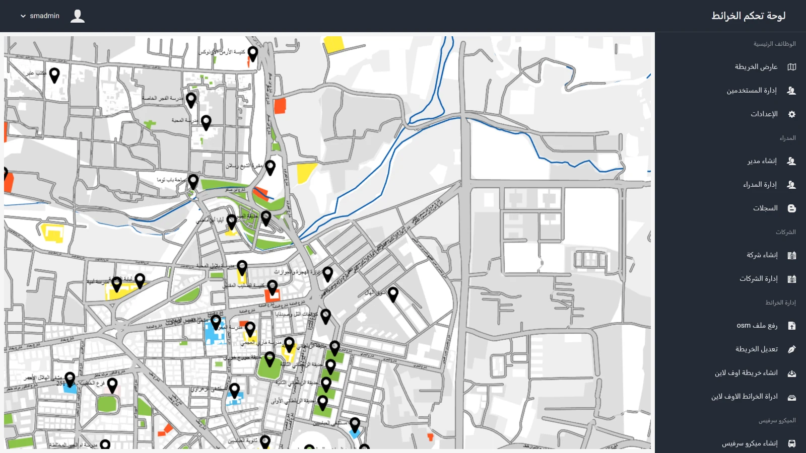
Captured from the Express, MongoDB and Canvas 2D dashboard in the original repository, filled with its archived OSM files. The experience at the top of this page is a browser recreation of the same ideas.
From route finding to the tools that keep a map useful.
Production code, supporting tools and experiments, with their roles made clear.
A typed HTTP backend with geographic map blocks, application models and a MongoDB 2dsphere index.
OSM ingestion, coordinate transformations, a custom map renderer, spatial indexing and graph traversal.
Server-rendered dashboard pages and browser tools for map editing, route previews and administration.
Authentication, password hashing, persistent dashboard sessions, uploads and an email-verification hook.
Browser bundles, server compilation, process management, log tooling and a supplied API request collection.
Early interface studies explored Flutter, React and polygon rendering alongside the core system. These experiments are separate from the production backend and dashboard.
Have a similarly specialized problem?